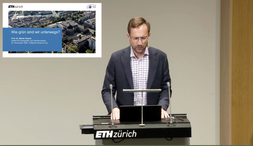
Prof. Dr. Martin Raubal gave a talk on how green are we on the road (in German) at the Treffpunkt Science City event. The presentation is available online here.
Mobility Information Engineering Lab at ETH Zürich
Prof. Dr. Martin Raubal gave a talk on how green are we on the road (in German) at the Treffpunkt Science City event. The presentation is available online here.
Prof. Raubal gave a talk at the Fachtagung Elektromobilität Conference on Geographic information Analysis for Future Electric Mobility: Smart Charging and Energy Saving Potentials (in German).

We welcome Ye as our new team member! He holds a B.Sc. in GIS and remote sensing from Sun Yat-sen University, China, and an M.Sc. in Geomatics from ETH Zurich. His work will focus on understanding human mobility behavior and develop models for mobility prediction.
Read more here!
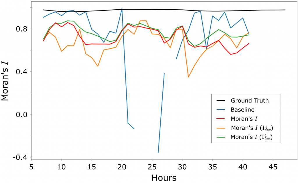
In our recently published 2021 GIScience paper “Estimation of Moran’s I in the Context of Uncertain Mobile Sensor Measurements“, we study the problem of how to quantify the spatial autocorrelation of samples that were recorded at different points in space and time. Such data is commonly produced by mobile sensors, e.g., the temperature sensors of cars, but also by social phenomena such as location checkins of people. As not only the sensors move, but also the phenomena (potentially) change over time, an autocorrelation value such as Moran’s I can either be inaccurate or impossible to compute due to a lack of data. Instead, we propose to weigh the contribution of different samples based on an empirically projected uncertainty. This weakening of the impact of uncertain samples leads to more stable estimations of spatial autocorrelation quantifications such as Moran’s I.
Dominik Bucher has successfully defended his doctoral thesis titled “Spatio-Temporal Information and Communication Technologies Supporting Sustainable Personal Mobility” on 21 September 2020.
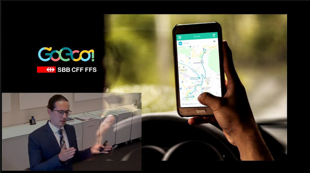
His research revolved around the question of how smartphone-tracked individual mobility data can be analyzed and utilized to support people in transitioning towards sustainable mobility usage. To this purpose, analysis methods (that identify transport modes, extract preferences and context, and detect changes in behavior), routing algorithms (that put an emphasis on personalized inter-modal transport involving a large number of transport options) and communication strategies (based on research on motivation and persuasion and evaluated using the large-scale mobility study GoEco!) were presented. Overall, if individual mobility data is used to give people eco-feedback and alternative route options in a timely manner, it is successful in helping people think about and adopt more sustainable mobility styles.

We welcome Dr. Yanan Xin as our newest team member. After successfully completing her PhD at the Pennsylvania State University, she joins the MIE lab in the role of the lead researcher.
In our recent publication “Exploring Factors that Influence Individuals’ Choice Between Internal Combustion Engine Cars and Electric Vehicles“, we use a large dataset of people owning both an Internal Combustion Engine (ICE) car as well as an Electric Vehicle (EV) to determine the impacts of various predictor variables on their choices between the two car types. The gained insights may give additional information to assess common uncertainties regarding EVs: “How far can I drive with a fully charged vehicle? How quickly does the battery wear out? Does the reduced range and/or lack of a substantial number of charging stations impact my mobility?”
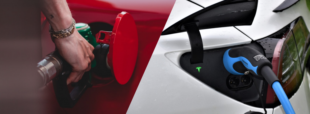
We find that chocies between ICE cars and EVs are regular considering an individual user, but that it is almost impossible to guess how someone will choose for a given trip if nothing about the person is previously known. This is a strong indication that most trips can easily be performed with any of the two vehicle types, and only individual preferences and circumstances determine the choices.
Christian Sailer has successfully defended his doctoral thesis on 25 May online via Zoom about the topic “Enhancing Knowledge, Skills, and Spatial Reasoning through Location-based Mobile Learning”.
Enhancing Knowledge, Skills, and Spatial Reasoning through Location-based Mobile Learning. In a few minutes I will defend my research of the last 6 years with #omleth. Many thanks for the collaboration @Innovedum @projuventute @SATW_ch @OpenDataZH @CeviSchweiz @schabelera pic.twitter.com/84Pf91TSlQ
— 𝓒𝓱𝓻𝓲𝓼𝓽𝓲𝓪𝓷 𝓢𝓪𝓲𝓵𝓮𝓻 (@csailer80) May 25, 2020
His research describes how an Location-based Mobile Learning (LBML) system utilizing GIS technology enhances the educational learning outcomes with a special focus on the spatial thinking process. Furthermore, this dissertation describes novel approaches of visual analytics with 2D and 3D map web components to produce new teaching strategies during the activities and new metacognitive strategies to evaluate and reflect the activity.
His presentation includes the study of case studies in universities, vocational schools, and informal education environments using design-based research to develop a mobile-friendly interactive mapping platform and the main study conducted in a secondary school under real conditions. Here, the evaluation focused on the impact of the technology regarding the learning performance and the teaching activities before, during, and after the activity. The results reveal a better cognitive learning outcome in classroom exams when a teaching sequence of several weeks includes an outdoor activity of a double lesson. Moreover, there is potential for enhancing learning beyond the outdoor part to improve spatial reasoning. Long-term self-assessment of the learners, however, resulted in no impact, whether cognitively or affectively. The workload for outdoor teaching compared to classroom teaching is higher mainly due to the profound inspections of the location. The findings and their implications for research and teacher education were discussed in order to corroborate the educational value of LBML to motivate educators using LBML strategies for teaching.
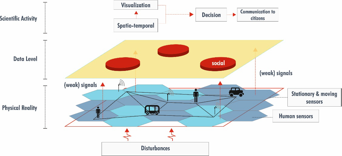
The second phase of the FRS programme at the Singapore-ETH Centre officially started on April 1st with an online research kick-off meeting. It was launched in the midst of a global crisis – COVID-19, highlighting the need to better understand and foster resilience. Within FRS-II there is a particular emphasis on social resilience to enhance the understanding of how socio-technical systems perform before, during and after disruptions. MIE Lab researchers will contribute within a research cluster focusing on distributed cognition (led by Martin Raubal). More specifically, we will develop a methodology and prototype for detecting weak signals in mobility data to identify potential disruptions.
Our former lab member Dr. David Jonietz recently gave an interview regarding how geospatial data and a digital map of the world can help transform mobility. Currently a research group leader at HERE Technologies, David Jonietz points out how we can step beyond simple maps to create more comprehensive digital representations of reality, which in turn can be used for traffic prediction and management, optimization of mobility systems, and more.