Home

Welcome to the Mobility Information Engineering Lab (MIE) at ETH Zürich. The MIE Lab is part of the Chair of Geoinformation Engineering at the Institute of Cartography and Geoinformation (IKG).

Our research is centered around analyzing spatio-temporal aspects of human mobility and developing methods to increase its sustainability with information and communication technology (ICT).

Research

We develop innovative computational methods for the analysis, simulation & prediction of individual mobility, with the goal of making mobility sustainable.

For this, we combine competences and methods from diverse fields such as Geographic Information Science (GISc), Artificial Intelligence (AI), Data Mining, Transportation Modeling, Spatial Cognition, and Learning Analytics. Our interests span from location-based services (LBS), trajectory data analysis, agent-based models and simulation, algorithms and models for spatio-temporal information, to mobile learning visualizations and learning analytics.

In our research we also place great value on reproducibility and transparency of our work. For this purpose we publish our code on the MIE Lab Github page, and for example provide the Trackintel Python package to standardise preprocessing steps of mobility data.

Read more about our research in the following core areas:

Sustainable Mobility

Location-based services to support people in mobility choices, MaaS offers, sustainability assessments

Computational Methods

Spatio-temporal machine learning, analysis, simulation & prediction of human mobility, user profiling and personalization
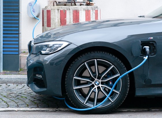
Mobility & Energy

Vehicle-2-grid strategies, smart charging, impact of drivetrain technologies, spatio-temporal assessments of technology penetration

News

New paper on rethinking bikeability indexes using multi-criteria analysis techniques

Our new paper, “Rethinking Bikeability Indexes: Fusing Knowledge Graph and MCDA Technique for Multi-criteria Bike Network Evaluations,” was presented by Ayda Grisiute at the 28th AGILE Conference on Geographic Information Science, 10–13 June 2025. It introduces a novel method for evaluating bike infrastructure by integrating a curated knowledge graph of bikeability metrics with the Analytic …

New paper on 3D land use planning for making the future cities measurable

Our paper “3D Land Use Planning: Making Future Cities Measurable with Ontology-Driven Representations of Planning Regulations” was presented by Ayda Grisiute at the 28th AGILE Conference on Geographic Information Science, 10–13 June 2025. The work addresses the challenge of evaluating long-term urban strategies by transforming fragmented and inconsistent planning regulations into a unified, machine-readable knowledge …

New study published in Transportation Research Interdisciplinary Perspectives

Our paper on “A causal intervention framework for synthesizing mobility data and evaluating predictive neural networks” has been published open-source in Transportation Research Interdisciplinary Perspectives! We introduced a Causal Intervention Framework that enables controlled manipulation of mobility-related behavior in synthetic location sequences. This enables us to evaluate how specific behaviors influence the performance of next-location …