New TGIS Paper is Online – “Street-level Traffic Flow and Context Sensing Analysis”

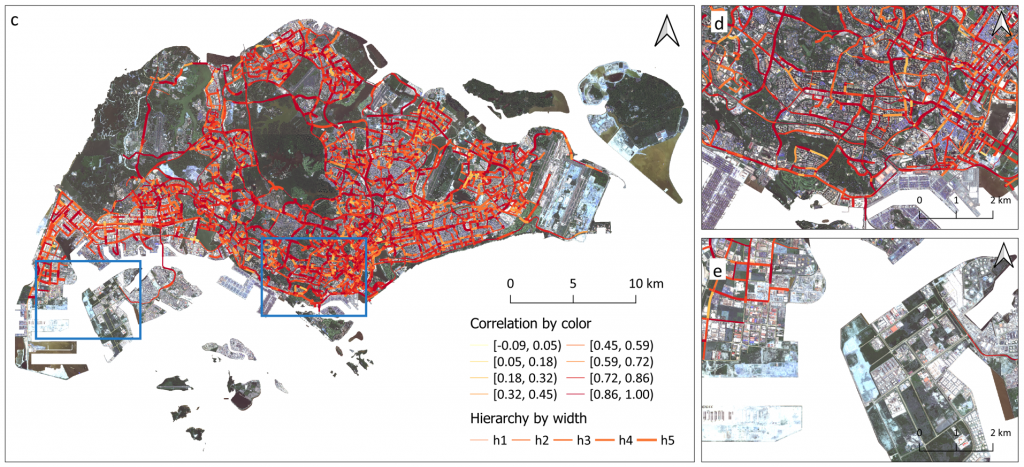
Our new paper entitled “Street-level traffic flow and context sensing analysis through semantic integration of multisource geospatial data” by Yatao Zhang and Martin Raubal is now online at TGIS.

Sensing urban spaces from multisource geospatial data is vital to understanding the transportation system in the urban context. However, the complexity of urban context and its indirect interaction with traffic flow deepen the difficulty of exploring their relationship. This study proposes a geo-semantic framework first to generate semantic representations of multi-hierarchical urban context and street-level traffic flow, and then investigate their mutual correlation and predictability using a novel semantic matching method. The results demonstrate that each street is associated with its multi-hierarchical spatial signatures of urban context and street-level temporal signatures of traffic flow. The correlation between urban context and traffic flow displays higher values after semantic matching than those in multi-hierarchies. Moreover, we found that utilizing traffic flow to predict urban context results in better accuracy than the reversed prediction. The results of signature analysis and relationship exploration can contribute to a deeper understanding of context-aware transportation research.

Kick-off of the e-bike city lighthouse project

What if 50% of the existing urban road space was allocated to e-bikes and the slow modes? Seven chairs at the department for civil engineering at ETH join forces to analyze the opportunities and effects of an urban future giving priority to cycling, micromobility and public transport. Our group will contribute with the developement of spatial optimization methods for redistributing the street lanes to design the new bike lane network, considering constraints such as (multi-modal) accessibility and exposure levels of the lanes.

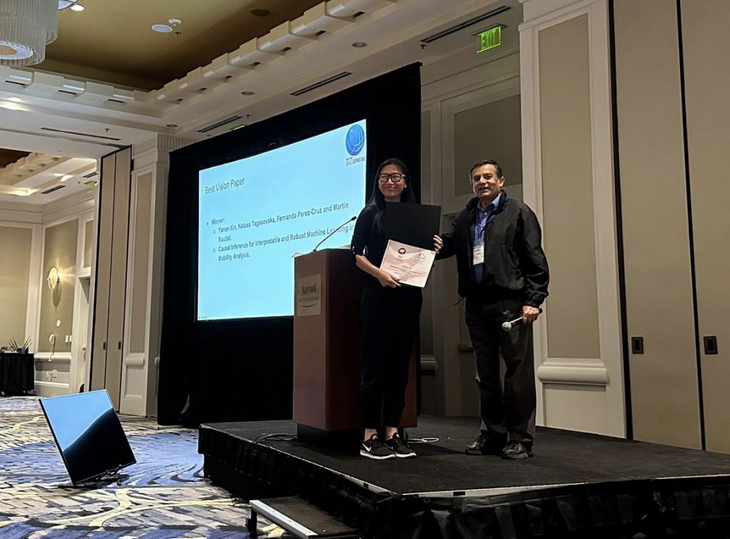
Received Best Vision Paper Award at the ACM SIGSPATIAL’22 Conference

Our paper “Causal Inference for Interpretable and Robust Machine Learning in Mobility Analysis” won the Best Vision Paper Award at the 30th ACM SIGSPATIAL Conference in Seattle, USA. This year’s vision paper selection has been very competitive given the large number of submissions. Among the six selected vision papers invited for presentation, our paper, presented by Dr. Yanan Xin, received the best vision paper award. In this paper, we envision opportunities for utilizing causal inference to enhance the interpretability and robustness of deep learning methods and address challenges in mobility analysis. This direction will help us build safer, more efficient, and more sustainable future transportation systems. For more information, check out our paper and a pre-recorded video presentation.

The vision paper also highlights what we aim to achieve through our project “Interpretable and Robust Machine Learning for Mobility Analysis”. Stay tuned for more exciting results coming from the project!

New SIGSPATIAL Paper Is Online – “Improving next location prediction”

We are delighted to announce that our paper “How do you go where? Improving next location prediction by learning travel mode information using transformers” by MIE Lab members Ye Hong, Henry Martin, and Martin Raubal is now online at arXiv and will be presented at ACM SIGSPATIAL, November 1–4, 2022, Seattle, WA, USA conference.

In this work, we propose a transformer decoder-based neural network to predict the next location an individual will visit based on her historical locations, time, and travel modes. In particular, we design an auxiliary task to jointly predict the next travel mode, with the aim of guiding the learning process of the network. We conduct extensive experiments on two real-world GPS tracking datasets and conclude that considering additional aspects of travel behaviour significantly increases the performance of next location prediction. The overall architecture of the proposed model is shown below.

MIE-Lab Represented at World Cities Summit, 2022

The resilience of a road network refers to its ability to bounce back to the desired level of serviceability after a disruption. After an accident, a more resilient transportation network can restore the flow of traffic faster than a less-resilient network. At the WCS Science of Cities Symposium, researchers from MIE-lab presented the preliminary findings from their recent research in which they used incidence clearance duration as a proxy for road network resilience. Does scale matter while modelling incidence clearance time? Should we use uniform or heterogeneous grids while modelling incidence clearance time? Questions like these and several others were addressed using real incident and congestion data from road networks in Singapore. Their findings reveal that incidence clearance duration is better modelled by splitting the road network into connected regions of similar topology. The notions of connected regions and urban topologies have a special place in urban road network planning because, on one hand, connected regions of similar topologies allow for the spread of traffic congestion, whereas on the other hand, these present an opportunity to share accident clearance resources within the connected region. The abstract proceedings can be found here. Look out for their upcoming pre-print!

MIE-Lab Members Co-Organized and Attended the Zurich Mobility Data Workshop

MIE-Lab members attended the Zürich Mobility Data Workshop sponsored by IARAI at the University of Zürich on July 20th. The workshop brought together researchers based in Zurich that work on different mobility research topics to discuss the results and insights learned in the NeurIPS Traffic4cast competition series organized by IARAI. The workshop sparked a lively discussion on the challenges and opportunities of open mobility data. The workshop is co-organized by Yanan Xin, Cheng Fu (GIScience Center, UZH), together with Christian Eichenberger and Moritz Neun (Institute of Advanced Research in Artificial Intelligence, IARAI).

Best paper award at AGILE conference

Our paper “Unlocking Social Network analysis methods for studying human mobility” received the Best Paper Award at the 25th AGILE Conference on Geographic Information Science! Nina Wiedemann presented the paper in Vilnius, Lithuania, and it was elected by the audience out of three papers pre-​selected by the conference committee. In the paper we demonstrate how network modelling methods can help to gain insights into the topology and spatial layout of mobility graphs. For more details, see the publication in the conference proceedings.

New article in Renewable & Sustainable Energy Reviews published

How well can you charge your battery electric vehicle with solar power generated from your own roof?


Our latest journal article “Using rooftop photovoltaic generation to cover individual electric vehicle demand—A detailed case study” shows that this works surprisingly well even without a dedicated battery home storage.
The article was also featured in the ETH News and other media outlets. Check out the press release or the journal article published in Renewable & Sustainable Energy Reviews (open access).

3rd place in the Traffic4cast 2021 extended challenge

Nina Wiedemann of MIE Lab achieved 3rd place in the NeurIPS 2021 Traffic4cast competition!
In this year’s extended challenge, the task was to predict traffic volume and speed in unknown cities, based on movie-format spatio-temporal data. Our team could improve the generalisation ability of the convolutional neural network with a patch-based approach. For more details on the method, check out our preprint on arXiv.