A paper titled “Anomaly Detection for Volunteered Geographic Information: A Case Study of Safecast Data” by Dr. Yanan Xin is recently published online.
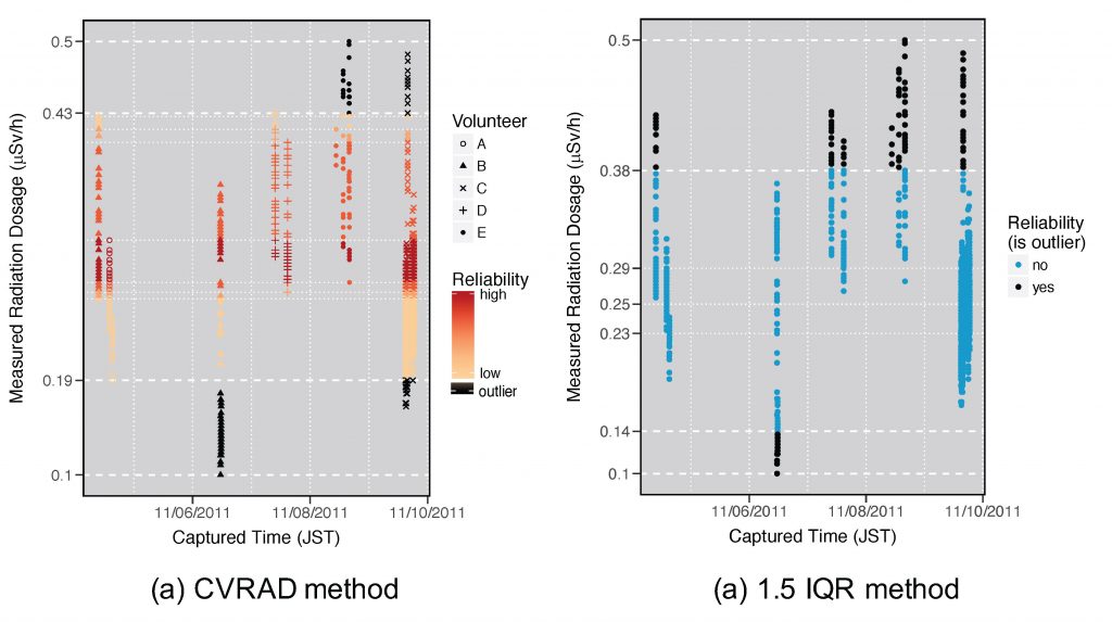
Volunteered Geographic Information (VGI) is a promising new data source for scientific research. However, many scientists are concerned about the quality of VGI data for research, given the lack of rigorous and systematic quality control procedures. This study contributes to the improvement of VGI quality by proposing a Cross-Volunteer Referencing Anomaly Detection (CVRAD) method to filter anomalous measurements in mobile environmental sensing data, using the crowdsourced Safecast radiation data set as a case study. The method is validated using both official KURAMA car-borne survey data and filtered measurements by Safecast moderators. The validation results demonstrate that the anomaly detection method can successfully identify abnormal values and reduce errors in the VGI data when sufficient volunteers are present; thereby increasing the overall accuracy of the data. The code developed to support the findings of the paper is available in figshare.com.