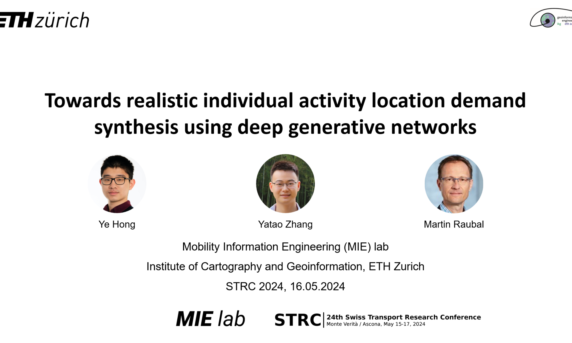
Ye Hong gave a talk at the Swiss Transport Research Conference (STRC) 2024 with the title Towards realistic individual activity location demand synthesis using deep generative networks. Reach out if you are interested in the topic and want to learn more!
New paper in the Journal of Big Data: Where you go is who you are
Location data is extremely sensitive, revealing where we spend how much time, what we like to do in our free time, and how we spend our money. Our new study titled “Where you go is who you are – A study on machine learning based semantic privacy attacks” sets out to answer a critical question: Just how much “semantic information” – that is, detailed and potentially sensitive insights into personal behavior – can be extracted from someone’s location data using machine learning techniques, especially when this data might be inaccurate or incomplete?
To address this question, we conducted a study using a dataset of location visits from a social network, Foursquare, where the category of the location (e.g., “dining” / “sports” / “nightlife”) is known. We simulate the following scenario: An attacker only knows the geographic coordinates and time of a location visit, and trains a machine learning model to infer the place category. Crucially, the geographic coordiates can be imprecise due to GPS inaccuracies or protection measures. This is simulated by obfuscating the true geographic coordinates with varying radius.
Our experiments reveal a significant privacy risk even with imprecise location data. Although the accuracy of the attacker decreases exponentially with the obfuscation radius, there remains a high privacy loss even if the coordinates are perturbed by up to 200m. A certain risk remains from the temporal information alone. These findings highlight the privacy risks associated with the growing databases of tracking and spatial context data, urging policy-makers towards stricter regulations.
Check out our paper and source code!
New JTRG paper online – Travel mode detection
Our new paper entitled “Evaluating geospatial context information for travel mode detection” was accepted at Journal of Transport Geography and is now available (open-access!) online.
How much does geospatial context information contribute to travel mode detection?
Our latest study reveals that geospatial network features, such as distance to the road network, are more critical than motion features, such as speed and acceleration, when classifying an extensive list of travel modes. Still, most land-use and land-cover features barely contribute to the task. The results are based on our extensive context representation reviews and the proposed analytical pipeline to assess the contribution of geospatial context information based on a random forest model and the SHapley Additive exPlanation (SHAP) method.
The study provides valuable guidance for feature selection, effective feature design, and building efficient travel mode detection models.
Check out the paper online and the corresponding code on Github!
New TR_C paper online – Context-aware next location prediction
Our new paper entitled “Context-aware multi-head self-attentional neural network model for next location prediction” was accepted at Transportation Research Part C: Emerging Technologies and is now available (open-access!) online.
We present a multi-head self-attentional (MHSA) neural network that integrates location features, temporal features, and functional land use contexts for next location prediction. This comprehensive approach effectively captures movement-related spatio-temporal information, leading to state-of-the-art performance on GNSS mobility datasets.
Our analysis demonstrates that training the model on population data yields superior results by learning from collective movement patterns, surpassing the capabilities of individual-level models. Moreover, we emphasize the significance of recent past movements and weekly periodicity, showing that learning from a subset of historical mobility is sufficient to obtain an accurate location prediction result.
The proposed model represents a pivotal advancement in accurate and interpretable individual mobility prediction, and can be readily applied in downstream applications, including planning on-demand transport services, implementing mobility incentives, and suggesting alternative mobility options.
Check out the paper online and the corresponding code on Github!
Yatao Zhang Presented at ICRS 2023
Yatao Zhang presented how to measure and analyze urban resilience using nighttime light data at ICRS 2023. ICRS is the International Conference on Resilient Systems held in Mexico City from 28th to 30th June.

Welcome Ayda Grisiute to MIE Lab!
Ayda Grisiute joins MIE Lab on May 1st as a Ph.D. student. Before joining MIE Lab, Ayda worked as a researcher at Singapore-ETH Centre for the Cities Knowledge Graph project. Ayda has a background in architecture and city planning. She received her master’s degree in Architecture from Aalto University, Finland, and her bachelor’s degree in Architecture from Vilnius Academy of Arts, Lithuania. In her previous studies, Ayda focused on algorithmic and data-driven design methodologies. Ayda is excited about urban knowledge management and representation with graphs and she is looking forward to an amazing journey at MIE Lab. We are happy to have her join the team!

The Open Digital Twin Platform Project Kick-Off Event
On March 30th the kick-off event for the project “An Open Digital Twin Platform for Research on the Swiss Mobility System” (ODTPR-SMS) took place at the LEE building together with our research partners at the Institute for Transport Planning and Systems, the Swiss Data Science Center and the Center for Sustainable Future Mobility. In the latter, the Geoinformation-Engineering group is a key stakeholder. The project is part of the Swiss National Strategy and Action Plan for Open Research Data and funded by swissuniversities through a Swiss Open Research Data Grant and has been acquired by our lab member Jascha Grübel. ODTPR-SMS has been funded with 1.5 million CHF (matched funding) to develop an Open Digital Twin Platform to underpin development on a mobility-specific Digital Twin “CH on the move”. In the kick-off meeting, all involved parties agreed on the timeline, distributed tasks, discussed the licensing of the software and got to know each other. Everybody was thrilled to contribute to strategically important tool chain that will be developed in the coming 24 months. As part of the project, 2 postdocs will join us at the Center for Sustainable Future Mobility to develop key features of the system.
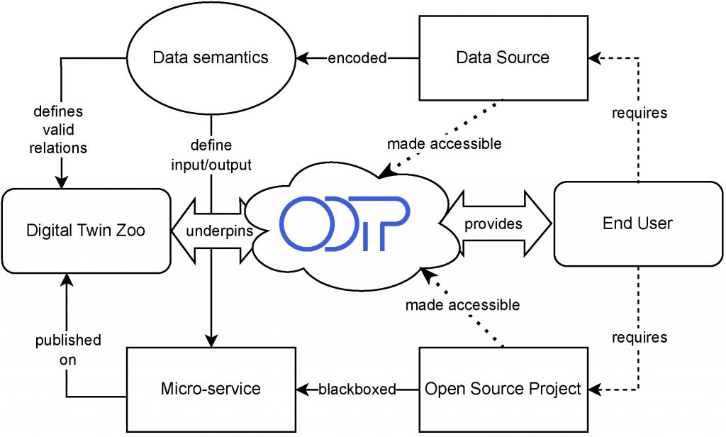
The Open Digital Twin Platform (ODTP) is bringing together cloud computing, data semantics, licensing, access control and visualisation to enable a holistic processing of data covering data acquisition, data representation, data processing, data analysis and data visualisation. Known tools for mobility research can be automated within ODTP to provide (micro-)services and apply to new scenarios with less overhead than ever before. ODTP takes care of the provisioning and deployment of software allowing researchers to focus on their scientific questions rather than how to get the technology working. To quickly assemble a new Digital Twin, ODTP makes use of a “Digital Twin Zoo” that hosts key software as containers readied to be micro-services. Throughout our project ODTPR-SMS, we will develop a first set of mobility related micro-services that include well-known tools such as MATSim, eqasim and our own trackintel. We are also making available as many data sources on Swiss mobility as possible starting with the National Data Infrastructure for Mobility (NaDIM).

Figure: Overview of ODTP for end users. ODTP facilitates access to open-source software and data through a container-based backend and hosting infrastructure.
ODTP will be accompanied by an open standard for digital twinning. We are looking for experts to evaluate our platform and if you are interested in mobility, digital twins or a combination thereof, please contact Jascha Grübel (jgruebel@ethz.ch) for details on how to join our evaluation board which will be published at the Center of Sustainable Future Mobility’s website. We are also looking forward to add more mobility related software tools to ODTP and we are interested to discuss potential new services, again please contact Jascha Grübel for more details (jgruebel@ethz.ch).
Reference: Grübel, J., C. Vivar Rios, M. Balać, Y. Xin, R. M. Franken, S. Ossey, M. Raubal, K. W. Axhausen and O. Riba-Grofnuz (2023a) “CH on the move”: Introducing the Prototype Digital Twin of The Swiss Mobility System, paper presented at the Swiss Transport Research Conference 2023.
CSFM Seminar Talk on Spatial Data Analytics for Sustainable Mobility
Professor Martin Raubal and Thomas Hettinger from SBB will give the first Center for Sustainable Future Mobility (CSFM) seminar talk on spatial data and data analytics for sustainable mobility on 23 March 2023, 17:00-18:10 at ETH Zentrum CAB G 51, ETH Zurich. For more information, please check here.

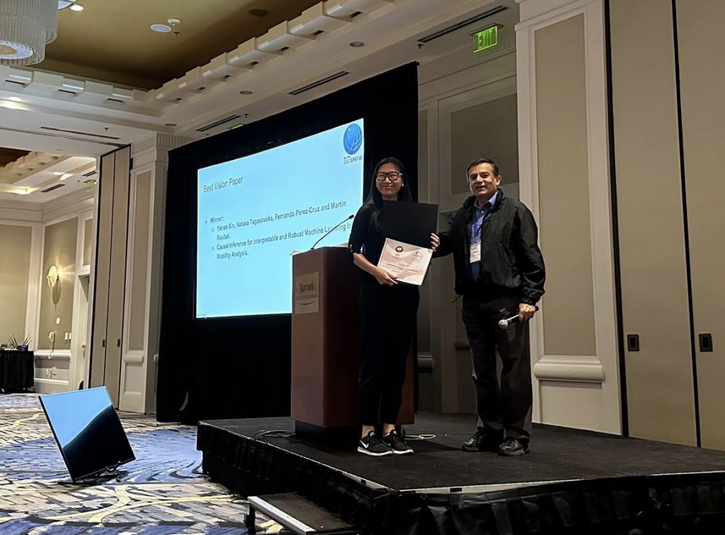
Received Best Vision Paper Award at the ACM SIGSPATIAL’22 Conference
Our paper “Causal Inference for Interpretable and Robust Machine Learning in Mobility Analysis” won the Best Vision Paper Award at the 30th ACM SIGSPATIAL Conference in Seattle, USA. This year’s vision paper selection has been very competitive given the large number of submissions. Among the six selected vision papers invited for presentation, our paper, presented by Dr. Yanan Xin, received the best vision paper award. In this paper, we envision opportunities for utilizing causal inference to enhance the interpretability and robustness of deep learning methods and address challenges in mobility analysis. This direction will help us build safer, more efficient, and more sustainable future transportation systems. For more information, check out our paper and a pre-recorded video presentation.
The vision paper also highlights what we aim to achieve through our project “Interpretable and Robust Machine Learning for Mobility Analysis”. Stay tuned for more exciting results coming from the project!

MIE-Lab Represented at World Cities Summit, 2022
The resilience of a road network refers to its ability to bounce back to the desired level of serviceability after a disruption. After an accident, a more resilient transportation network can restore the flow of traffic faster than a less-resilient network. At the WCS Science of Cities Symposium, researchers from MIE-lab presented the preliminary findings from their recent research in which they used incidence clearance duration as a proxy for road network resilience. Does scale matter while modelling incidence clearance time? Should we use uniform or heterogeneous grids while modelling incidence clearance time? Questions like these and several others were addressed using real incident and congestion data from road networks in Singapore. Their findings reveal that incidence clearance duration is better modelled by splitting the road network into connected regions of similar topology. The notions of connected regions and urban topologies have a special place in urban road network planning because, on one hand, connected regions of similar topologies allow for the spread of traffic congestion, whereas on the other hand, these present an opportunity to share accident clearance resources within the connected region. The abstract proceedings can be found here. Look out for their upcoming pre-print!


