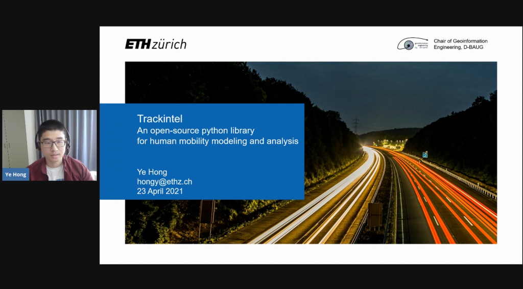
Ye Hong introduced the trackintel framework at GeoPython 2021. Trackintel is an open-source python framework for human mobility modelling and analysis. Find out more on GitHub.
Mobility Information Engineering Lab at ETH Zürich
Ye Hong introduced the trackintel framework at GeoPython 2021. Trackintel is an open-source python framework for human mobility modelling and analysis. Find out more on GitHub.
We welcome Yatao Zhang to our team as a PhD student at the Singapore-ETH Centre. Yatao received his Master of Science degree in Cartography and Geographical Information System from Wuhan University, and a Bachelor of Science degree in Geographical Information Science from Sun Yat-sen University in China.
The book chapter titled Geosmartness for Personalized and Sustainable Future Urban Mobility by Prof. Dr. Martin Raubal, Dr. Dominik Bucher, and Henry Martin from the book Urban Informatics is now available online. This chapter demonstrates how geosmartness, a combination of novel spatial-data sources, computational methods, and geospatial technologies, provides opportunities for scientists to perform large-scale spatio-temporal analyses of mobility patterns as well as to investigate people’s mobile decision making.
We have a new opening for a Ph.D. position in Mobility Information Engineering. Check here for more details. We are looking forward to your applications!
A new paper titled Applying Frequent-Pattern Mining and Time Geography to Impute Gaps in Smartphone-Based Human-Movement Data by Dr. Pengxiang Zhao, Dr. David Jonietz, and Prof. Dr. Martin Raubal is published in the International Journal of Geographical Information Science (IJGIS).
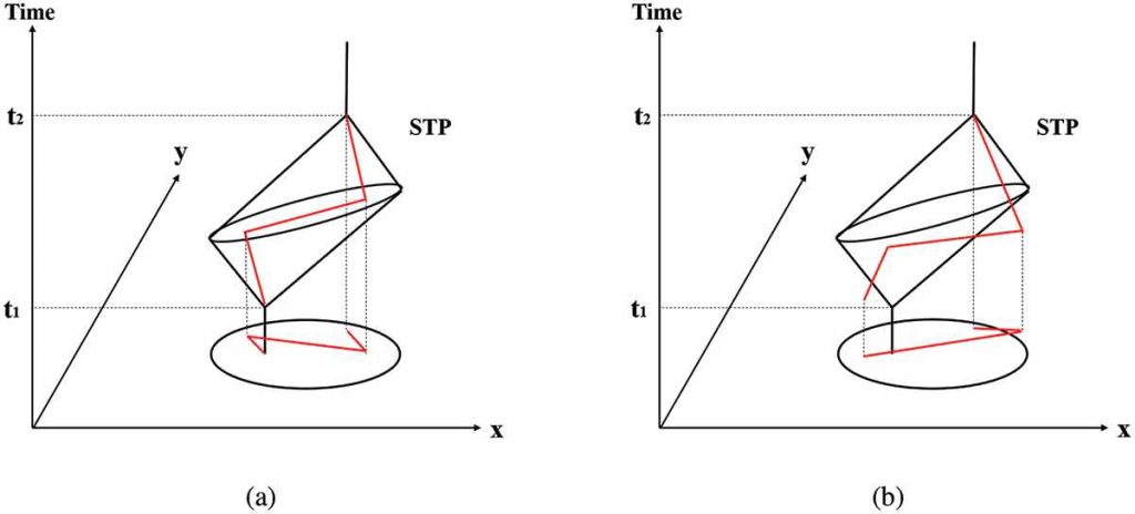
Abstract: Though GPS-based human trajectory data have been commonly used in travel surveys and human mobility studies, missing data or data gaps that are intrinsically relevant to research reliability remain a critical and challenging issue. This study proposes a novel framework for imputing data gaps based on frequent-pattern mining and time geography, which allows for considering spatio-temporal travel restrictions during imputation by evaluating the spatio-temporal topology relations between the space-time prisms of gaps and corresponding frequent activities or trips. For the validation, the proposed framework is applied to raw GPS trajectories that were collected from 139 participants in Switzerland. In the case study, the temporal and spatio-temporal gaps are artificially generated by randomly choosing activities and trips from the trajectory data. Through comparing the mobility indicators (i.e. duration and distance) calculated from raw data, imputed data, and data with gaps, we quantitatively evaluate the performance of the proposed method in terms of Pearson correlation coefficients and deviation. We further compare the framework with the shortest path interpolation method based on the generated spatio-temporal gaps. The comparison results demonstrate the performance and advantage of the proposed method in imputing gaps from GPS-based human movement data.
The figure above shows a hypothetical gap with its Space-Time Prism and two potential candidate trips.
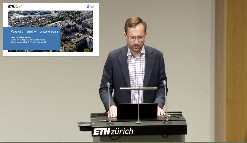
Prof. Dr. Martin Raubal gave a talk on how green are we on the road (in German) at the Treffpunkt Science City event. The presentation is available online here.
Prof. Raubal gave a talk at the Fachtagung Elektromobilität Conference on Geographic information Analysis for Future Electric Mobility: Smart Charging and Energy Saving Potentials (in German).

We welcome Ye as our new team member! He holds a B.Sc. in GIS and remote sensing from Sun Yat-sen University, China, and an M.Sc. in Geomatics from ETH Zurich. His work will focus on understanding human mobility behavior and develop models for mobility prediction.
Read more here!
Christian Sailer has successfully defended his doctoral thesis on 25 May online via Zoom about the topic “Enhancing Knowledge, Skills, and Spatial Reasoning through Location-based Mobile Learning”.
Enhancing Knowledge, Skills, and Spatial Reasoning through Location-based Mobile Learning. In a few minutes I will defend my research of the last 6 years with #omleth. Many thanks for the collaboration @Innovedum @projuventute @SATW_ch @OpenDataZH @CeviSchweiz @schabelera pic.twitter.com/84Pf91TSlQ
— ????????? ?????? (@csailer80) May 25, 2020
His research describes how an Location-based Mobile Learning (LBML) system utilizing GIS technology enhances the educational learning outcomes with a special focus on the spatial thinking process. Furthermore, this dissertation describes novel approaches of visual analytics with 2D and 3D map web components to produce new teaching strategies during the activities and new metacognitive strategies to evaluate and reflect the activity.
His presentation includes the study of case studies in universities, vocational schools, and informal education environments using design-based research to develop a mobile-friendly interactive mapping platform and the main study conducted in a secondary school under real conditions. Here, the evaluation focused on the impact of the technology regarding the learning performance and the teaching activities before, during, and after the activity. The results reveal a better cognitive learning outcome in classroom exams when a teaching sequence of several weeks includes an outdoor activity of a double lesson. Moreover, there is potential for enhancing learning beyond the outdoor part to improve spatial reasoning. Long-term self-assessment of the learners, however, resulted in no impact, whether cognitively or affectively. The workload for outdoor teaching compared to classroom teaching is higher mainly due to the profound inspections of the location. The findings and their implications for research and teacher education were discussed in order to corroborate the educational value of LBML to motivate educators using LBML strategies for teaching.

The “Tag der Geomatik” is the GISDay of the University of Applied Sciences and Arts Northwestern Switzerland (FHNW) and ETH Zurich and gives insight into the versatility of the field of geoinformatics and surveying.
Der #tagdergeomatik ist bereits am Laufen. Schon mehr als 200 Schülerinnen und Schüler besuchen unsere Ausstellung und die Module in Aarau. Die Ausstellung kann noch bis 16h von allen Interessierten besucht werden. @HABG_FHNW #geomatik #vermessung #fhnw #eth pic.twitter.com/vniz2iGIuq
— IGEO FHNW (@igeoFHNW) November 13, 2019
This year’s event took place as part of the “200yrs Swiss Geo X” events at the Culture and Convention Centre in Aarau and was held under the motto: how is our habitat recorded, what do we learn from the spatial data obtained and how do these data enable the sustainable design of our future habitat.
Vielen Dank an alle interessierten Schülerinnen und Schüler am #tagdergeomatik die unsere AR-App für ihrer Kartenarbeit mit dem Schulatlas verwendet haben. pic.twitter.com/DznyvkLhqK
— Schweizer Weltatlas (@swissworldatlas) November 13, 2019
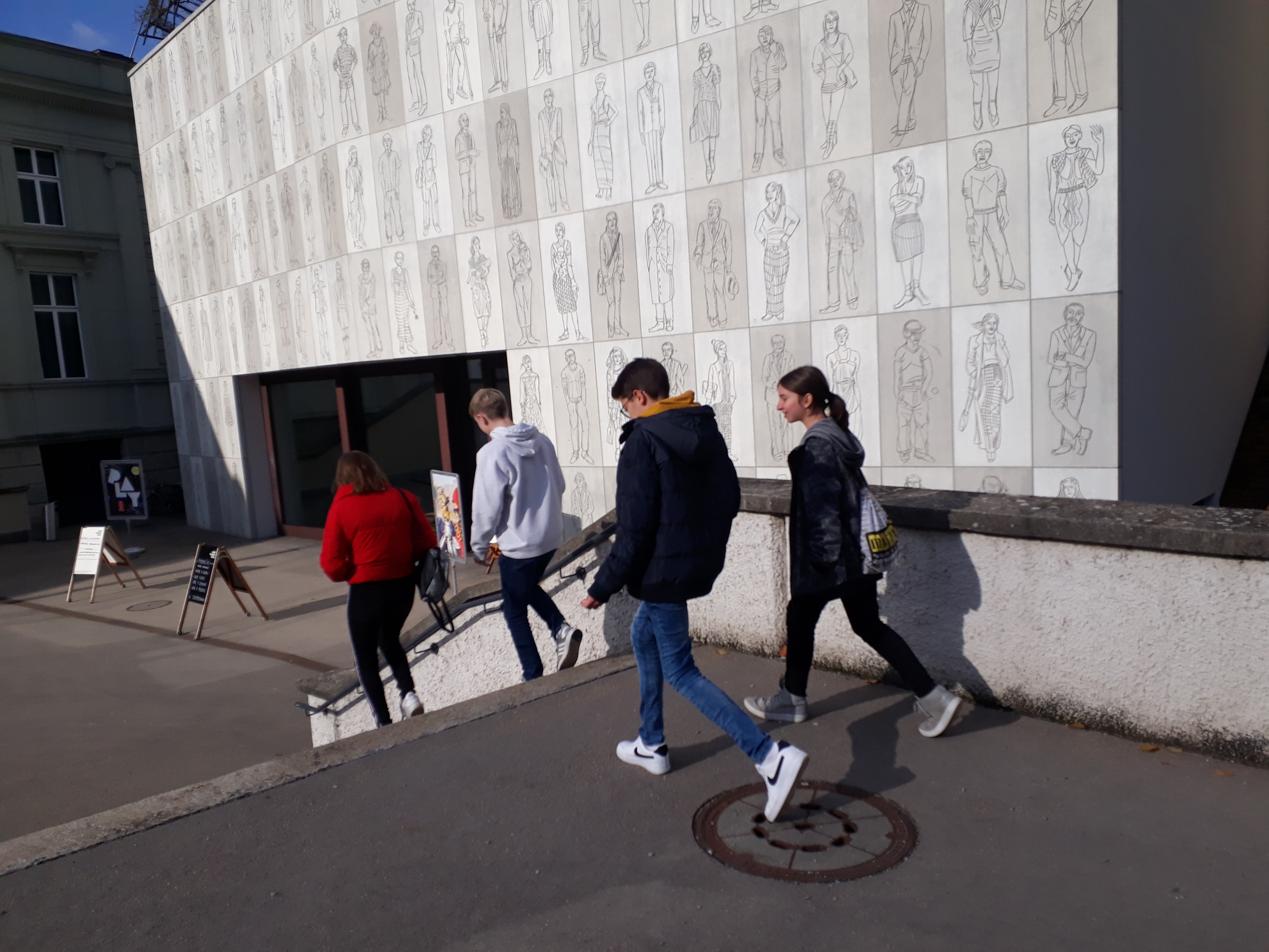
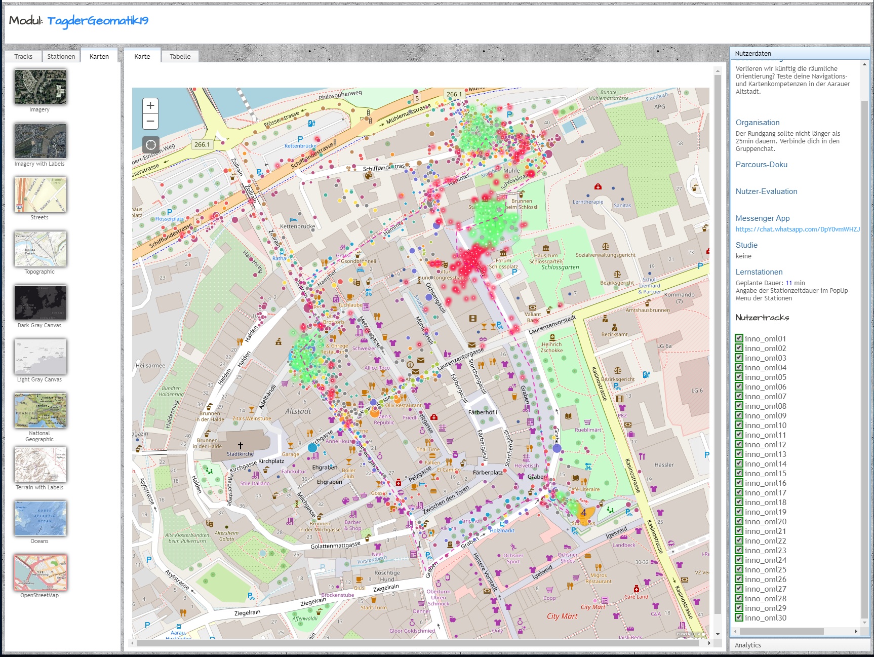
Our MIE-Lab module addressed the question whether we will lose spatial orientation in the future if we completely outsource navigation to a computer system and give up personal perception of space. This module with the ETH-App OMLETH took place outside in the old town of Aarau and provided GPS-based tricky exercises for spatial perception and orientation. Back in the congress centre the results were evaluated in classes, visualised (see the collection of six classes by 5 groups each) and discussed with the participants. A great event with a glittering feedback wall in the thumbs-up area.

Fazit meines #gisday am #tagdergeomatik mit rund 180 SuS: Geotech begeistert und ist relevant für die Problemlösung des Alltags. https://t.co/cCHKLTegYk
— Christian Sailer (@csailer80) November 15, 2019